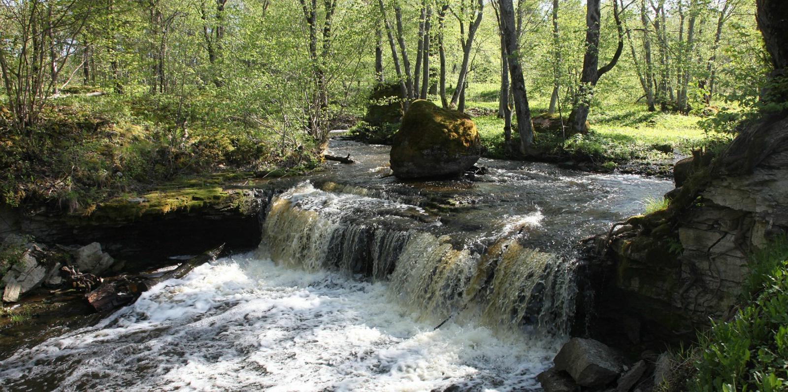
Aluoja is a unique valley with a limestone bed, where you can find small cliffs, springs and sinkholes. Cliffs are 1,4 m, 0,7 m, 1,9m, 1,3 m and 0,5 m in height in the downstream direction. The first two have formed in Volkov and the three top ones in Kunda stage limestone. The valley is up to 10 m deep, in places, and especially near the third drop the fall takes a canyon like form. On the side of the valley there are a couple of viewing platforms and a bridge to cross the river Aluoja.
![]() 4 km
4 km
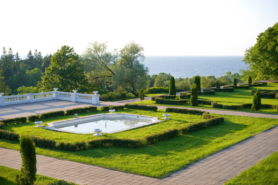
Oru park and the drandiose palace was built by Grigori Jelissejev – one of the wealthiest traders in 19. century Russia. In 1935 three Estonian industrialists bought the palace together with the park and gave it as a summer residence for president Päts. The palace for destroyed completely during world war II.
Today you can walk around in the beautifully maintained and clearly marked park with numerous differenct species of trees and bushes, look at Hõbeallika cave, enjoy picturesque views from the many viewing points and see the sunset in Pääsupesa.
Toila beach is unique, with sandy surface in the sea but covered with pebble rocks on the shore. Often you can find driftwood spat out by the sea bringing natures artwork right at your feet. You can get to Toila beach through the beautiful trails of Oru park. Free parking is available near the main entrances and also a handful of parking places near the beach, which are for extra cost during summer season.
![]() 4 km
4 km
Päite cliff is 41 metres high and the sea is approximately 50-70 metres from the cliff. Päite cliff is a 7 km section between Voka and Sõtke klint on the Ida-Viru klint section. From the north it is bordered by a 40-metre continuous almost straight lined Ontika type klint. For preservation of the cliff Päite nature preserve has been formed.
![]() 7 km
7 km
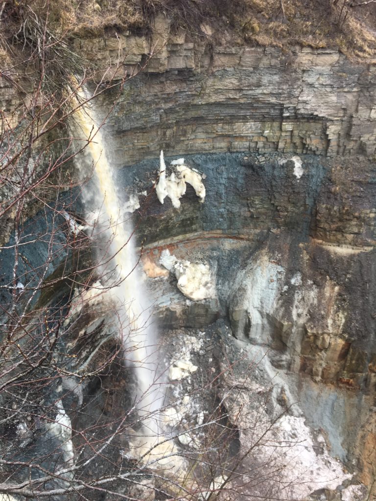
Approximately 30 metres high, Valaste waterfall is the highest in Estonia and in Baltics. It is a mandmade waterfall getting its waters from drainage ditches also known as Valaste stream. Locals call it Suurkraaviks (Bigditch).
In 2018 Valaste hiking train was reopened which allows for spectacular views both on sea and to the klint offering a change to see the cliff from below.
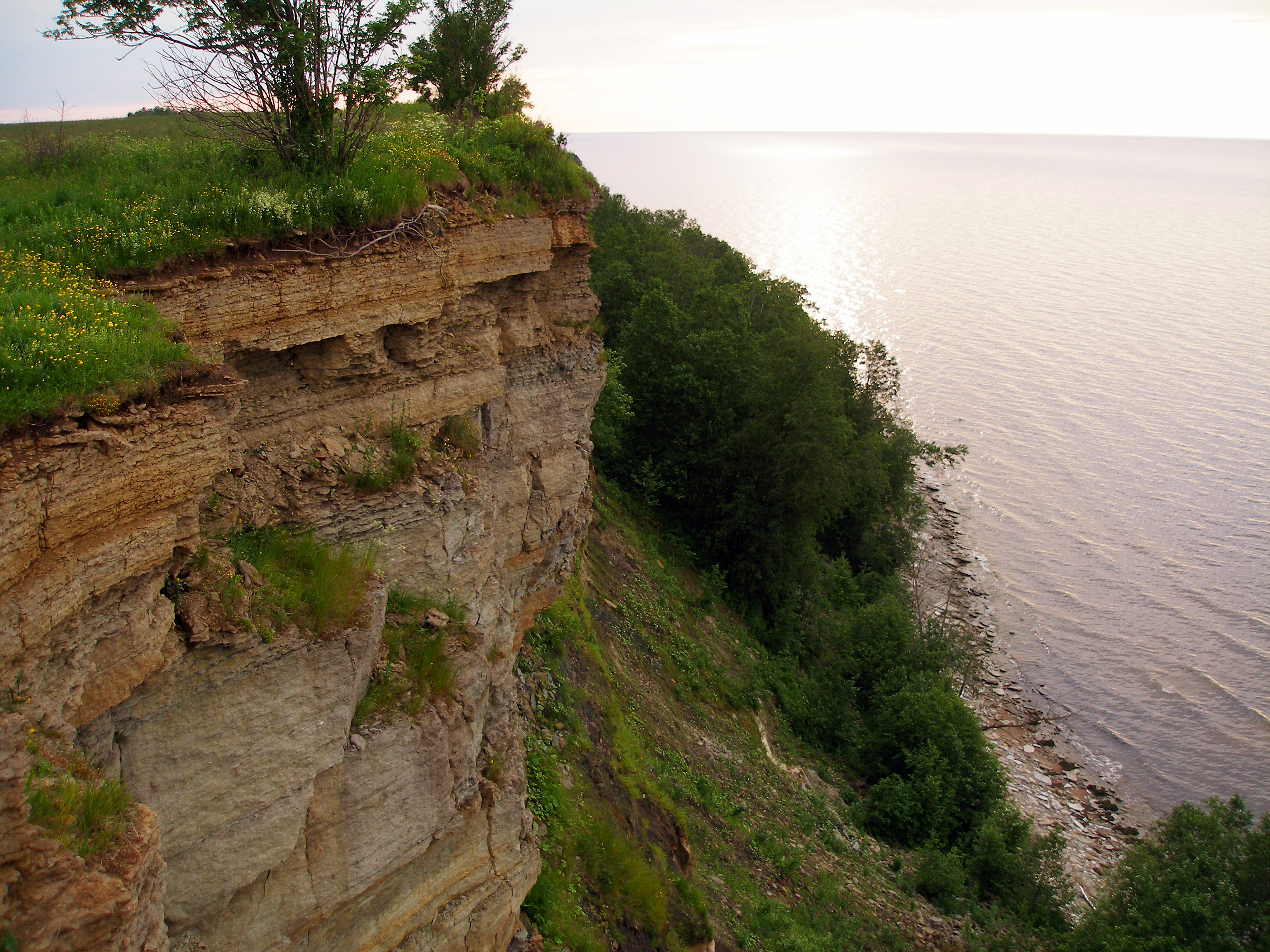
Being created in 1939 Ontika is one of Estonias oldest nature preserves. Ontika nature preserve covers the most spectacular part of North-Estonias sea cliff from Saka to Toila, where a continuous wall of limestone rises to 56 metres from sea-level. In this 20 km section of cliff there are only a couple of places that are suitable for descending, and even those are steep and narrow. Withing the boundary of the preserve are three waterfalls: Valaste, Karjaoru and Kivisilla. On the norther coast Cambrian and Ordovician body of ore are exposed. There are record of finding 9 protected plant species in the preserve.
![]() 15 km
15 km
Every town is beautiful and unique in its own way. Located in the northeast of Estonia in Ida-Viru County, Sillamäe is not an exception. Its originality is an alloy of history, economy, a geographical position and human destinies and qualities of people living here. Most Estonians could not visit it, as it was long time closed to visitors and kept secret because of its military industrial function. Today it is open for everybody and full of discoveries: you can freely visit local sights or enjoy your stay in many different ways.
Sinimäed or Vaivara Sinimäed are three interconnected west-easterly cliffs forming a kind of archipelago of cliffs. Sinimäed (Blue Mountains) are Torni cliff (69,9 m), Põrguaugu or Grenaderi cliff (83,2 m) and Park cliff of Orphanage hill (84,6 m). Extensive defensive battles took place in these Blue Mountains during the second world war. A memorial is built on Grenadere cliff for the fallen in these battles. The hills are not blue, however. The name comes from pre war period, when the hills were covered with spruce which gave the hills a blue look when looking at them from a distance.
![]() 14/21 km
14/21 km
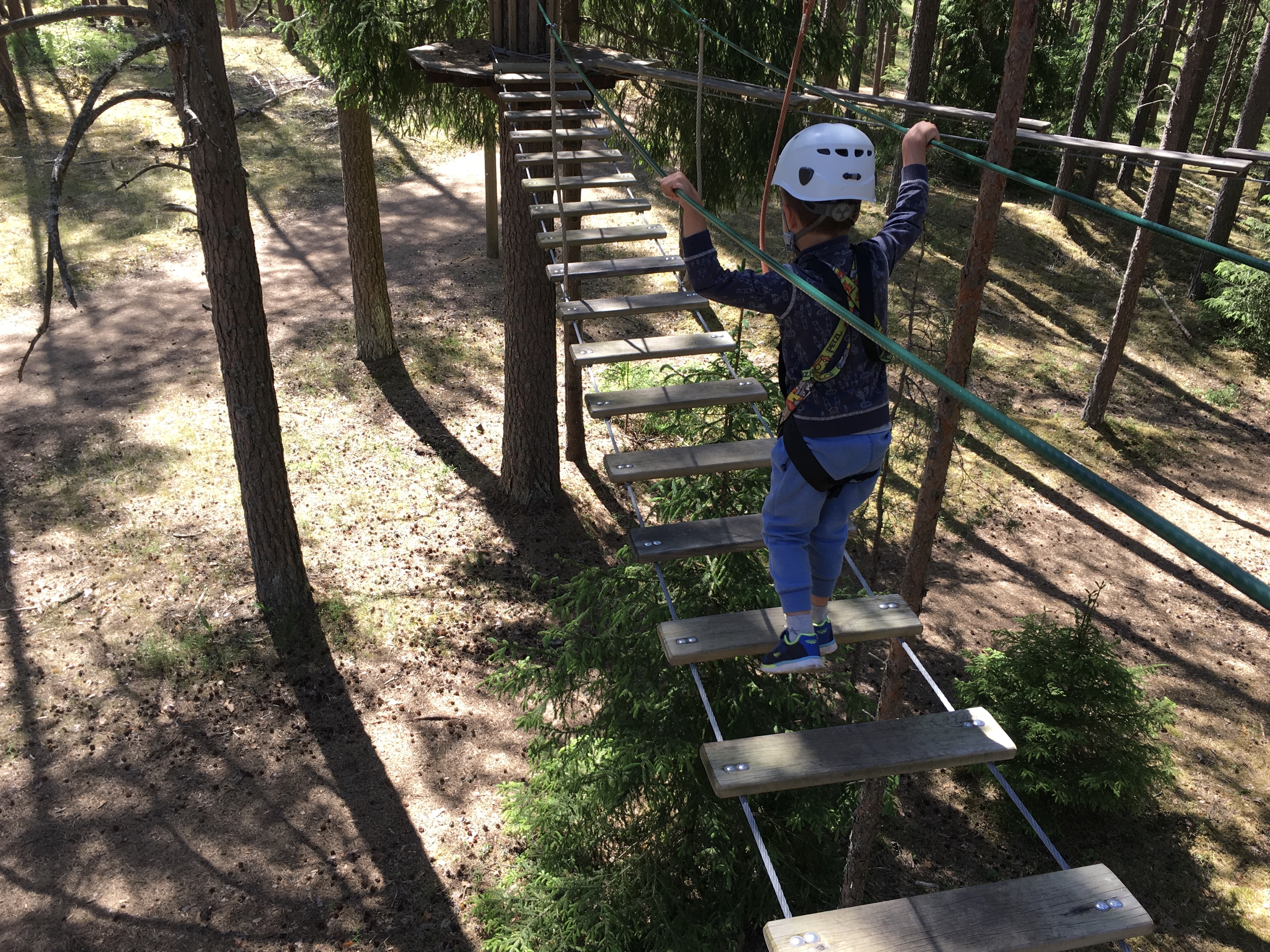
The adventure park has 5 trails with different level of difficulty together with long cable flying over a lake. On these 5 trails there are altogether 33 sporty games which require precision and attention. The trails are constructed in a way that each game is more difficult from the previous one. Visitors can test their balance, skilfulness and courage. The leap of Tarzan, performed at the height of 9 m, requires special amounts of courage. The lake flyovers are 400 and 200 m long. There is a separate trail with 22 games for kids from age of 4 and at least 110 cm in height.
Kurtna nature preserve is famous for the many lakes, 42 to be exact. It spreads of 2557 hectares and was created on 1987. Besides the lakes the purpose of the preserve is to protect Kurtna kame. Several protected species grow in this area.
![]() 22 km
22 km
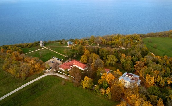
Saka Manor – the pearl of the North-Estonian coastal cliffs. It is a place high up on the limestone bank, where natural and cultural heritage meet: the mansion in neo-renaissance style risen from ruins and the limestone bank chosen as one of the Estonian national icons. Saka is one of the few manors in Estonia that has been fully restored. The mansion, reminiscent of Italian renaissance architecture, as well as newer buildings, surrounded by a park, have all been carefully renovated.
![]() 25 km
25 km
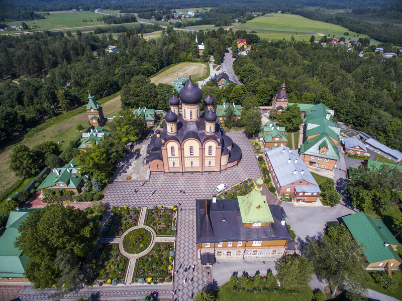
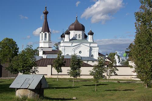
The Kuremäe Convent, located in the centre of Kuremäe, was established in 1891, and is the only functioning Russian Orthodox nunnery in Estonia. In ancient times, a sacred place of the Estonians was located here and a sacrificial spring was at the foot of the hill. The spring is knows as a “holy spring” today for the curative powers of its water. One can also bathe in the refreshing water. The convent gates are open and you can walk around and observe convent life. Those who are more interested in the life and history of the convent can order a tour from the nuns, in order to see the various churches in the convent complex that are otherwise closed to the public.
![]() 29 km
29 km
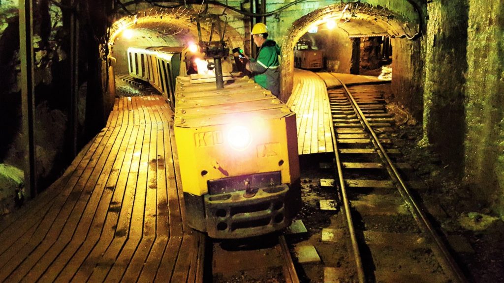
Would you like to get a taste of what the life of a real coal miner was like? All you need to do is put on your wellies, grab a warm jacket and take a lamp; because, where else but underground would you hear, see and feel the same things as the men who toiled away underground every day? The mining museum Enrichment Factory is also now open. An educational experience, it demonstrates the journey of oil shale, shows how energy is created and showcases information on the subject of future trends in the energy sector.
![]() 32 km
32 km
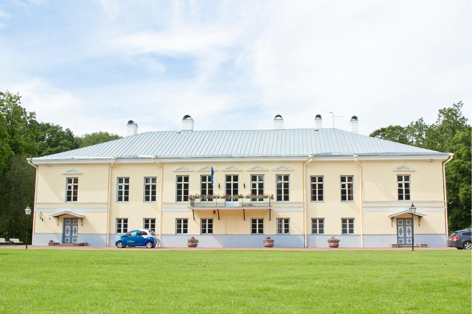
The manor house was first mentioned in 1542 and belonged to the von Rosens for a long time. The Early-Classicist two-storey main building, constructed in 1796, was rebuilt in the 19th century. It now houses a local municipality administration. Several outbuildings have artistic value – the renovated stable-coach house now houses the Mehntak hotel. About 3 kilometres from the main estate, one can find the Neo-Gothic cemetery chapel of the von Rosen family.
![]() 33 km
33 km
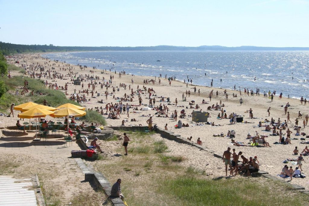
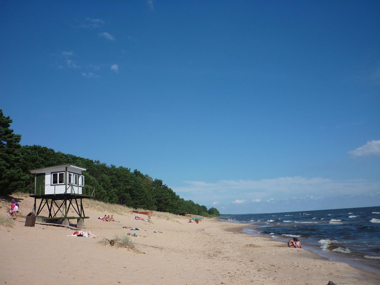
Narva-Jõesuu is famous for its unique nature. Thanks to its eight-kilometre-long white sand beach lined with pine trees – one of the best in Estonia – Narva-Jõesuu has long been a popular summer destination. Today it is also a populaar destination for SPA tourists.
![]() 35 km
35 km
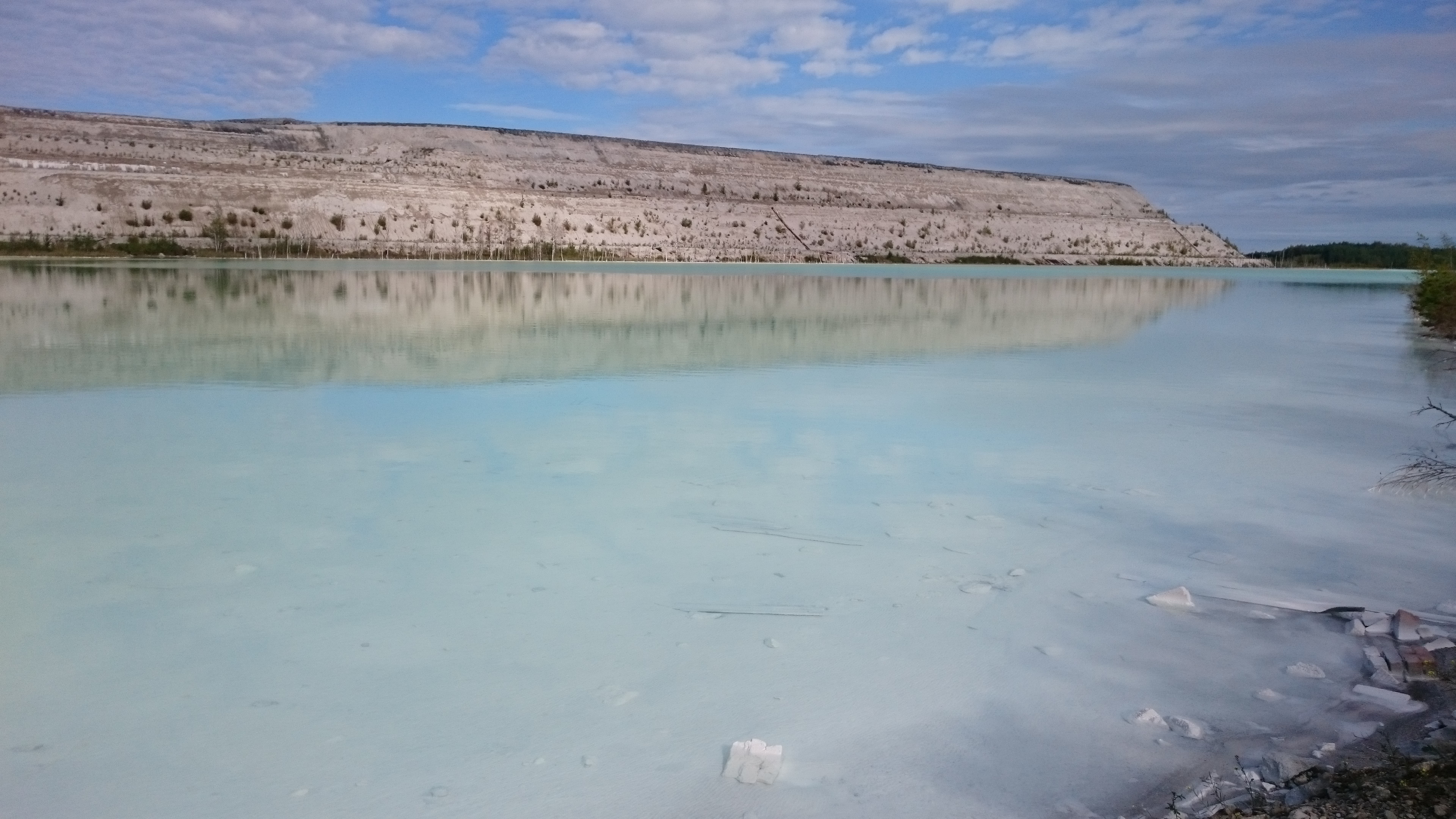
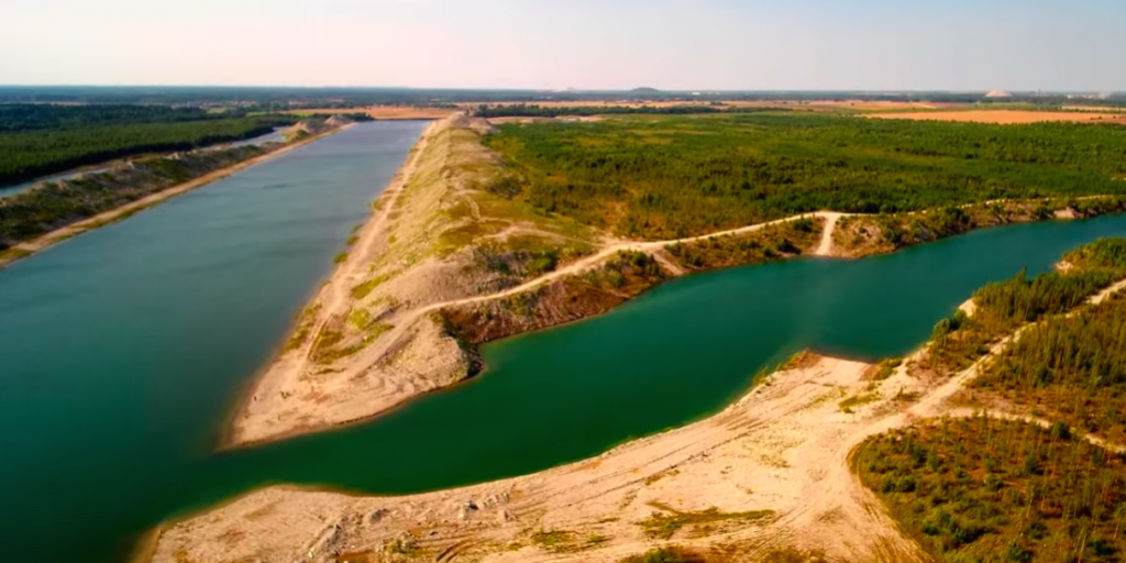
In reality this is a technical object serving the purpose of settlement pool for nearby power stations. The power stations run on oil shale and due to its properties large amounts of ash are left as waste. This ash is transported using water as medium. This part of water that is excess drains into these settlement pools. The beautiful turquoise colour is achieved due to small particles from carbonate rock, which scatters blue spectrum of light more than yellow and red. Generally, these lagoons are located on closed territory but in some places, you do get to see them up close ((59,273569; 27,935507).
![]() 35 km
35 km
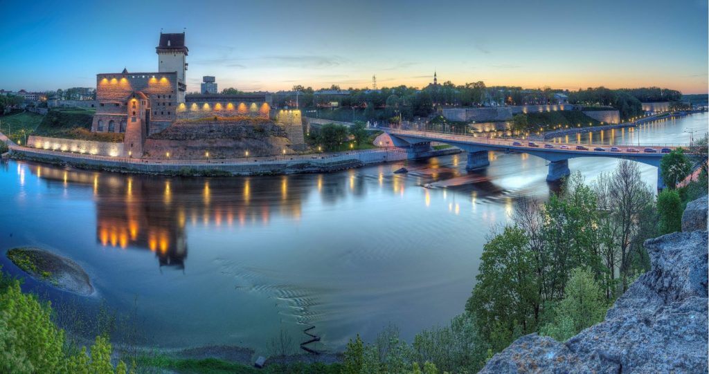
The frontier location of Narva is the most distinctive feature of the past and the present of the town. By the Middle Ages the historic border has been already running there, along the banks of rapid river swiftly flowing its waters out the Lake Peipus into the Baltic Sea and dividing the two civilizations – the Catholic European North and Orthodox Slavonic East. The integration of the opposites is unique in the whole Europe. Two giants of stone, towering in close vicinity to each other on two opposite banks (at distance of an arrow flight or that of a musket shot) - the castle of Order of Germanic knights and the Russian fortress of Ivangorod. However, the border is not a mere line that separates, but also a place where two cultural worlds meet, mutually influence and interpenetrate each other.
![]() 40 km
40 km
In the beach restaurant that can accommodate 70 people, which is located at the picturesque Liimala beach, you can enjoy exquisite food and the beautiful sea view both from the spacious restaurant hall and from restaurant terraces. The architect of the unique building which resembles a sea wave is Ralf Tamm. The Nordic interior design inspired by the sea and the coastal bootlegging was created by the interior architect Angela Orgussaar.
![]() 42 km
42 km
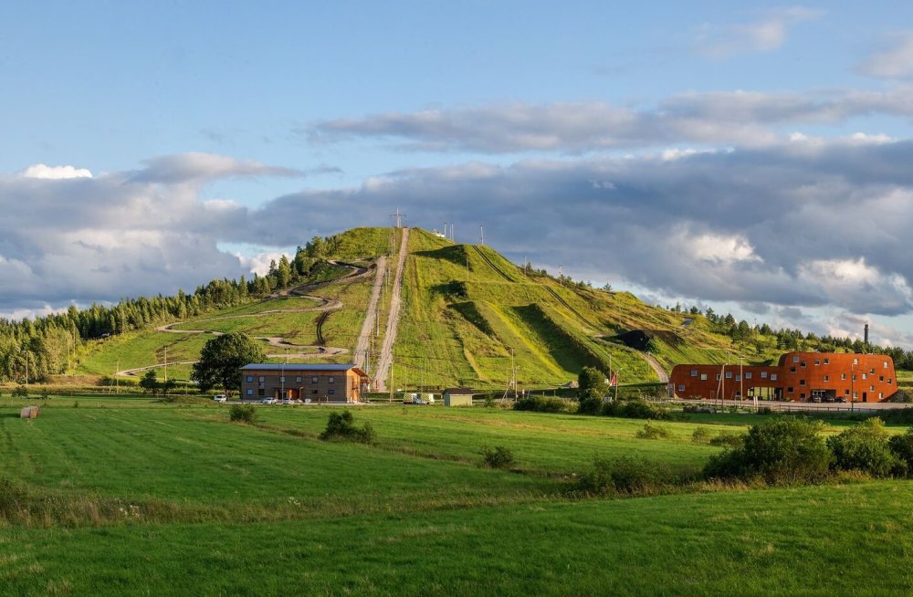
Kiviõli adventure park is built upon a closed artificial hill made up of shale oil processing waste (semi-coke). This industrial legacy has become a popular recreation spot for local and foreign visitors where there are plenty of fun activities all year round (sky slope, adventure park, rope descent, mountain cars, whole family fun park, moto centre etc). This artificial hill is the highest in the Baltics that is open for public rising approximately 100 m above sea level. From the top you witness enchanting views both to the industrial legacy and surrounding landscape.
![]() 44 km
44 km
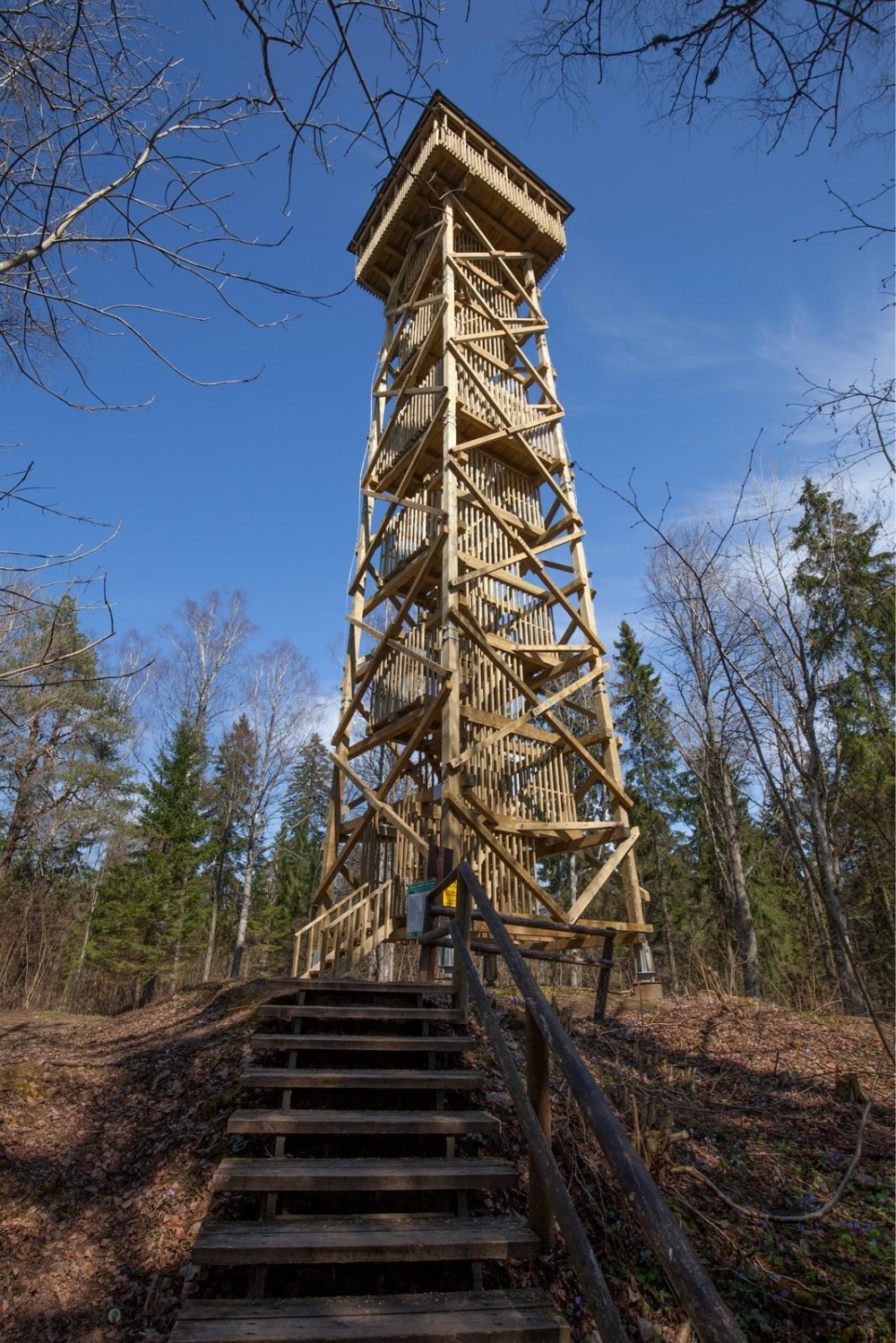
Iisaku hill is the second-highest place in Ida-Viru County after Uljaste esker. In clear weather, you can see the towers of Pühtitsa Convent, Lake Peipus, oil shale mines, mine residue landfills and bogs from the 28 m observation tower on top of the hill. The observation tower is situated on the highest natural peak in Ida-Viru County (94 m above sea level).
The Kotka hiking trail showcases different types of bogs and other wetland features. It passes by a sand ridge which developed over thousands of years as the result of the retreat of Lake Peipus. The transition the landscape makes to marshland is sudden and provides an interesting contrast for hikers. Following the boardwalk, you will see all manner of wetland features, from turf and hollows to bog pools and small lakes. At the mid-point of the trail are a cabin and a traditional Estonian structure, similar to a tepee, known as a ‘summer kitchen’. The trail begins in Iisaku and ends in Rüütli bog in the village of Alliku. It is 8 km long in total, although there is also a shorter, 1.5 km boardwalk in the Rüütli bog.
![]() 45/48 km
45/48 km
Aidu water park is a unique artificial landscape built on a former oil shale quarry where you can experience adventures on the water, in the water and by the water and where it is also possible to organise world-class sporting events. The beginning of Aidu water park marks a new era in the quarry, which is focused on developing the area into a positive future. The central idea for this area that has witnessed lost villages and mining is an underwater history world, which are introduced through different adventures organised both on land and in water.
![]() 47 km
47 km
One of the more picturesque lakes in East-Estonia. The surface area of the lake is approximately 60 ha with a maximum depth of 5,6 metres. On the shore you can find a bonfire site and a 3,8 km hiking trail. The trail introduces hikers the lake itself, ancient forest, esker and peatland. The trail runs mainly along the esker and is marked. On top of the esker also lies the highest natural point of East-Estonia (92,5 m).
![]() 55 km
55 km
The village arose in 14th century next to an Ordensburg of the Livonian Brothers, erected in 1349 on the north-eastern border of their Terra Mariana territory. There is a small boat harbour, a border guard cordon, a nunnery and the St Elijah Orthodox church. By its architecture Vasknarva is a common Peipsi Russian linear village where one-storey wooden buildings are situated side by side just beside the street.
![]() 55 km
55 km
To the west of Vasknarva the shore of lake Peipus is a perfect place for leisurely swimming and resting. The shoreline runs about 40 km and is mostly sandy, looking in the southerly direction. On the dunes there are bright pine forests. One of the more popular and known beaches is Kauksi. Between Kaukis and Kuru you can find so called singing sands. This phenomenon can be explained by the specific shape of sand grains and effect of wind working together, which result in a unique whistling music.
Lake Peipus together with lake Pihkva are the fourth largest lake in Europe (3540 km2) and 53 in world. The lake is divided into three sections – Peipus, Pihkva and lake Lämmi which connects the two.
![]() 58 km
58 km